Public Transportation
Bay Area Transportation Authority (BATA)
(231) 941-2324
info@bata.net
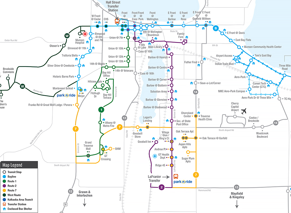
New! NMC’s Student Government Association has worked with BATA to incorporate a new bus route. This route begins at the Dennos and Milliken/Front and goes to Garfield, Hastings, and LaFranier. The cost is 75 cents for NMC students with ID. Buses arrive at the Dennos each hour on the :20 and at Milliken/Front on the :22.
 View the City Loop maps and schedules
- Route 5 stops at the Dennos Museum Center with departures every 60 minutes Monday through Friday.
- Route 5 travels along Garfield, Hastings, Hammond, and LaFranier Roads.
- Route 5 transfers with the Bayline at Front Street, and Route 2, Route 7 & Route 13 at the LaFranier Road Park-n-Ride.
- Transit stops include Trailside45 Apartments & the TART Trail, Father Fred, Save-a-Lot, Cherryland Center and the LaFranier Road Park-n-Ride.
View the Bayline route map and schedule
The Bayline is a free east-west route with a bus every 15 minutes Monday–Saturday and every 30 minutes on Sundays. Nearby stops are located on E. Front Street at the Milliken/Fair Street traffic signal.
- To head west towards downtown Traverse City and the NMC Hagerty Center/Great Lakes Campus, board at the heated/lighted bus shelter on the north side of the road at East Front Street and Milliken Drive.
- To head east towards Tom’s Food Market East Bay and the NMC Aero Park Campus, board at the heated/lighted bus shelter on the south side of the road at East Front and Fair streets (at the corner of the Grand Traverse County Civic Center property).
Plan your trip with Google Transit at google.com/transit, or download the Google Maps App and enter your “From” and “To” for bus routes, travel time and cost.
Students are eligible for reduced fares.
Get downtown with ease! Check out google.com/maps or BATA’s trip planning tool to use public transit to get to where you need to go.
Northwest Michigan Ride Share Connection
A ride-sharing resource for commuting students. Give or find a ride to class.